The 1830 Indian Removal Act and the Trail of Tears in Southern Illinois
The 1830 Indian Removal Act and the Trail of Tears in Southern Illinois
Compare arguments for and against the Indian Removal Act and analyzed GIS maps of the Trail of Tears.
The materials included here focus on two major lessons: 1) using an online reader created with CAST’s Universal Design for Learning (UDL) Book Builder and a graphic organizer to analyze primary sources for the Indian Removal Act of 1830 and 2) comparing primary sources with GIS maps of the Cherokee peoples’ forced migration through southern Illinois. In the first activity, it is important for students to identify how people use information about a culture as a “weapon” to support or oppress it. In the second activity, students have three options for analyzing maps in the Trail of Tears activity: 1) complete the black and white maps in questions document, 2) use the color maps provided, or 3) manipulate zoom and layer features in the online GIS map with the hyperlink provided below.
Teaching Resources
Indian Removal Act of 1830 Primary Sources in Book Builder
As an introduction to the Trail of Tears, this interactive online module supports students’ analysis and corroboration of multiple arguments for and against the U.S. government’s decision to remove the Cherokee people from New Echota in present-day northwest Georgia.
Graphic Organizer for Indian Removal Act of 1830 Primary Sources
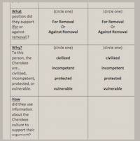
Students can use this printable graphic organizer to document their analysis of the sources found in the Book Builder activity listed in the above resource
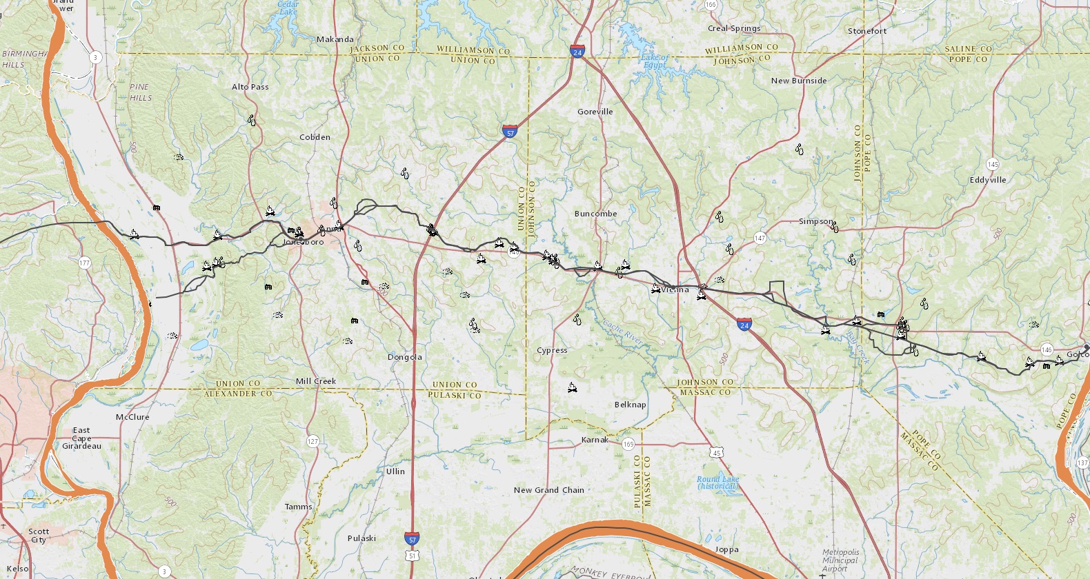
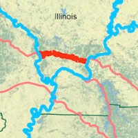
Interactive Geographic Information Systems (GIS) Map for Cherokee Trail of Tears
This interactive GIS map of the Trail of Tears through southernmost Illinois allows students to corroborate details such as the locations of Cherokee campsites, towns, mills, natural springs, and other physical features.
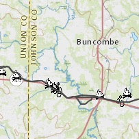
Trail of Tears in Southern Illinois Maps, Sources, and Questions
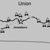
Included in this curriculum are excerpts from the journal of Daniel S. Butrick, a reverend who traveled with the exiled Cherokee people across southernmost Illinois. Students can corroborate this source with the GIS map listed in the above resource or the printable black and white map activities included here. Activity includes questions aligned with Common Core State Standards (CCSS) 1, 2, and 7.
Trail of Tears Color Maps 1 – 4
These maps are color versions of the ones used for the curriculum listed above and serve as downloadable resource educators can use as a key for the black and white map activities or project on a screen for classroom discussion.